
Google DeepMind, Alphabet Inc.’s artificial intelligence research arm, announced the release of AlphaEarth Foundations on Wednesday, a new AI model that can process terabytes of daily satellite data to track changes on the Earth’s surface.
The new model is being launched as part of the company’s Google Earth AI initiative, a collection of geospatial AI models and datasets that will provide help for researchers, businesses and organizations to tackle real-world problems facing the world today.
Google described the new AI model as one that functions like a “virtual satellite,” capable of accurately and efficiently mapping the entire land and coastal waters of the planet into a digital representation, called embeddings, which machine learning and AI algorithms can process.
“This allows the model to provide scientists with a more complete and consistent picture of our planet’s evolution, helping them make more informed decisions on critical issues like food security, deforestation, urban expansion, and water resources,” the AlphaEarth team said.
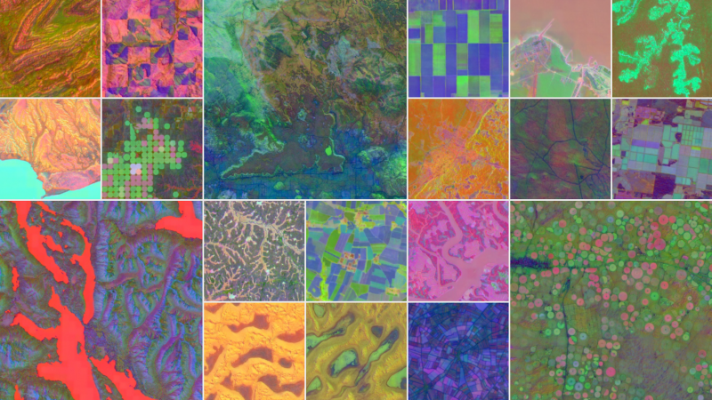
According to DeepMind, the model compiles vast volumes of information from dozens of public sources, including optical satellite images, radar, 3D laser mapping and climate simulation into 10-by-10-meter squares. That allows the model to track changes over time with high precision.
It compresses information by generating summaries that occupy 16 times less storage than traditional AI systems, thus reducing the costs of planetary-scale analysis. In tests, DeepMind said AlphaEarth had a 24% lower error rate than other models the team tested it against.
The company has already generated a powerful dataset for practical use in Google Earth Engine — the Satellite Embedding dataset, one of the largest of its kind, with more than 1.4 trillion embedding footprints per year. DeepMind said the dataset is already in practical use by organizations around the world, including the United Nations’ Food and Agriculture Organization, Harvard Forest, Group on Earth Observations, MapBiomas, Oregon State University, the Spatial Informatics Group and Stanford University.
Google Earth Engine, launched 15 years ago, is Google’s long-running multipetabyte catalog of satellite imagery and geospatial datasets for planetary-scale analysis.
“The Satellite Embedding dataset is revolutionizing our work by helping countries map uncharted ecosystems — this is crucial for pinpointing where to focus their conservation efforts,” said Nick Murray, director of the James Cook University Global Ecology Lab and global science lead of Global Ecosystems Atlas.
The Global Ecosystems Atlas initiative aims to map and monitor the world’s ecosystems using environmental data. It’s using the new dataset to help countries and governments classify unmapped ecosystems into categories such as coastal shrublands and hyper-arid deserts. Using this resource, organizations can know how to direct their resources to help combat the loss of biodiversity and prioritize conservation areas.
DeepMind said the model enables more scientists, researchers and governments to do something that wasn’t possible before: generate consistent, detailed maps of the world on demand without the need for satellites. With annualized tracking, data researchers can more easily make long-term comparisons across regions and time.
Including how Atlas is using the system, scientists can use the model to monitor crop health, track deforestation or observe new construction to track urban sprawl. Since the data is mapped in a rich manner, it can be searched, compared and combined with deep AI reasoning to create powerful planetary mapping information systems.
Images: Google
Support our open free content by sharing and engaging with our content and community.
Join theCUBE Alumni Trust Network
Where Technology Leaders Connect, Share Intelligence & Create Opportunities
11.4k+
CUBE Alumni Network
C-level and Technical
Domain Experts
Connect with 11,413+ industry leaders from our network of tech and business leaders forming a unique trusted network effect.
SiliconANGLE Media is a recognized leader in digital media innovation serving innovative audiences and brands, bringing together cutting-edge technology, influential content, strategic insights and real-time audience engagement. As the parent company of SiliconANGLE, theCUBE Network, theCUBE Research, CUBE365, theCUBE AI and theCUBE SuperStudios — such as those established in Silicon Valley and the New York Stock Exchange (NYSE) — SiliconANGLE Media operates at the intersection of media, technology, and AI. .
Founded by tech visionaries John Furrier and Dave Vellante, SiliconANGLE Media has built a powerful ecosystem of industry-leading digital media brands, with a reach of 15+ million elite tech professionals. The company’s new, proprietary theCUBE AI Video cloud is breaking ground in audience interaction, leveraging theCUBEai.com neural network to help technology companies make data-driven decisions and stay at the forefront of industry conversations.