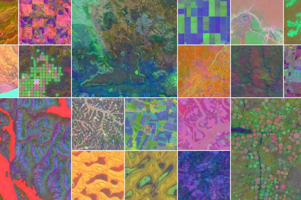
A new AI model that can map the Earth in “unprecedented detail” will allow scientists to have a more precise and real-time view of our changing planet
The system combines huge amounts of observation data and could be used to track climate change and other environmental issues.
Launched by Google DeepMind, the search engine’s AI research laboratory, AlphaEarth Foundations uses petabytes of Earth observation data to “accurately and efficiently” detail the entirety of the planet’s terrestrial land and coastal waters, DeepMind said in a statement.
A petabyte is a unit of data storage that’s equivalent to 1,000 terabytes (TB) or around a million gigabytes (GB)—or some 20,000 Blu-ray discs.
“This breakthrough enables scientists to do something that was impossible until now—create detailed, consistent maps of our world, on-demand,” DeepMind said.
“Whether they are monitoring crop health, tracking deforestation, or observing new construction, they no longer have to rely on a single satellite passing overhead. They now have a new kind of foundation for geospatial data.”

Google DeepMind
AlphaEarth Foundations provides a “more complete and consistent picture” of the Earth’s evolution, allowing researchers to make more informed decisions about food security, deforestation, urban expansion, water resources and other critical issues.
The new mapping system essentially functions like “a virtual satellite,” DeepMind explains. It integrates volumes of data from dozens of public sources, including optical satellite images, radar, 3D laser mapping and climate simulations, into a “unified digital representation,” or “embedding,” that can be easily processed by computer systems.
The new AI model analyzes land and coastal waters across the globe in 10×10 meter squares, allowing any changes over time to be monitored with incredible precision. The system’s key innovation is its ability to create a “highly compact summary” for each square of data.
DeepMind explains: “These summaries require 16 times less storage space than those produced by other AI systems that we tested and dramatically reduces the cost of planetary-scale analysis.”
AlphaEarth Foundations was found to be consistently the most accurate when stacked up against traditional methods and other AI mapping systems. It excelled at a range of tasks over various time periods, from identifying land use to estimating surface properties.
“Crucially, it achieved this in scenarios when label data was scarce,” DeepMind notes, “demonstrating its superior learning efficiency.”
On average, AlphaEarth Foundations was found to have around a 24 percent lower error rate than the other models tested, according to a study detailing the new system.
DeepMind has also released a collection of annual embeddings from AlphaEarth Foundations as the Satellite Embedding dataset in Google Earth Engine, the cloud-based geospatial analysis platform. The dataset is among “the largest of its kind with over 1.4 trillion embedding footprints per year,” the research lab said.
“Over the past year, we’ve been working with more than 50 organizations to test this dataset on their real-world applications,” DeepMind said.
Several organizations across the globe, including the United Nations’ Food and Agriculture Organization, Harvard Forest, Group on Earth Observations, MapBiomas, Oregon State University, the Spatial Informatics Group and Stanford University have already been using this dataset to create detailed custom maps.
“As new measurement platforms are launched, others decommissioned, and the accelerating pace of observational data collection pushes forward, we believe it is critical to support the community of applied scientists and practitioners deriving the insights about our planet that inform decision-making and policy action,” the researchers concluded.
Do you have a tip on a science story that Newsweek should be covering? Do you have a question about maps? Let us know via science@newsweek.com.
References
Brown, C. F., Kazmierski, M. R., Pasquarella, V. J., Rucklidge, W. J., Samsikova, M., Zhang, C., Shelhamer, E., Lahera, E., Wiles, O., Ilyushchenko, S., Gorelick, N., Zhang, L. L., Alj, S., Schechter, E., Askay, S., Guinan, O., Moore, R., Boukouvalas, A., & Kohli, P. (2025). AlphaEarth Foundations: An embedding field model for accurate and efficient global mapping from sparse label data. arXiv. https://arxiv.org/abs/2507.22291

